
Thank you for supporting this site ❤️
Make a donation
Make a donation
Gear up for your next adventure:
As an Amazon Associate, this site earns from qualifying purchases at no extra cost to you.
Llanca topographic map
Click on the map to display elevation.
Thank you for supporting this site ❤️
Make a donation
Make a donation
Gear up for your next adventure:
As an Amazon Associate, this site earns from qualifying purchases at no extra cost to you.
About this map
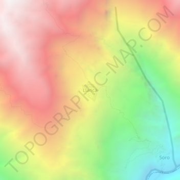
Name: Llanca topographic map, elevation, terrain.
Location: Llanca, Choco, Province of Castilla, Arequipa, Peru (-15.58173 -72.06723 -15.54173 -72.02723)
Average elevation: 3,248 m
Minimum elevation: 2,000 m
Maximum elevation: 4,310 m
Thank you for supporting this site ❤️
Make a donation
Make a donation
Gear up for your next adventure:
As an Amazon Associate, this site earns from qualifying purchases at no extra cost to you.