Geolocate

Conococha topographic map

Click on the map to display elevation.

About this map

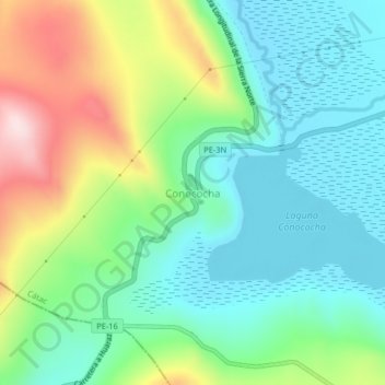
Name: Conococha topographic map, elevation, terrain.

Location: Conococha, Cátac, Recuay, Áncash, Perú (-10.14365 -77.31257 -10.10365 -77.27257)

Average elevation: 4,128 m

Minimum elevation: 4,012 m

Maximum elevation: 4,385 m

Other topographic maps

Click on a map to view its topography, its elevation and its terrain.

Laguna Querococha

Perú > Áncash > Cátac

Average elevation: 4,174 m

Gear up for your next adventure:

🚲Bike Repair Kit - Essential tools for on-trail mechanical issues
🥽Outdoor Goggles - Protective eyewear for outdoor activities
🦶Anti-Blister Balm - Prevents friction and hotspots during long ascents
🛶Waterproof Dry Bags - Keep electronics and clothes dry during river crossings
🛰️Satellite Messenger - Emergency communication for areas with no cell service

As an Amazon Associate, this site earns from qualifying purchases at no extra cost to you.