Geolocate

Farmington topographic map

Click on the map to display elevation.

About this map
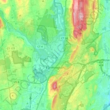
Name: Farmington topographic map, elevation, terrain.

Location: Farmington, Capitol Planning Region, Connecticut, United States (41.68797 -72.90847 41.77621 -72.76197)

Average elevation: 90 m

Minimum elevation: 25 m

Maximum elevation: 242 m

Other topographic maps

Click on a map to view its topography, its elevation and its terrain.

Gear up for your next adventure:

🥾Waterproof Hiking Boots - Essential footwear for rugged terrain and wet Canadian trails
🧢Hiking Hat - Sun-protective and breathable hats for long treks
🧭GPS Handheld Device - Reliable GPS navigation for outdoor adventures
⛺Camping Groundsheet - Protect your tent from moisture and dirt
🧶550 Survival Paracord - Versatile utility cord for emergency repairs and rigging

As an Amazon Associate, this site earns from qualifying purchases at no extra cost to you.