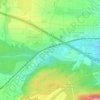
Deufringen topographic map
Click on the map to display elevation.
About this map

Name: Deufringen topographic map, elevation, terrain.
Average elevation: 500 m
Minimum elevation: 405 m
Maximum elevation: 580 m
Other topographic maps
Click on a map to view its topography, its elevation and its terrain.


Aidlingen
Germany > Baden-Württemberg > Landkreis Böblingen
The municipality (Gemeinde) of Aidlingen is found in the district of Böblingen, in the German state of Baden-Württemberg. Aidlingen lies on the western edge of Böblingen district, along its border with Calw's district, and physically in the Heckengäu and the Upper Gäu [de] regions. The main watercourse in…
Average elevation: 481 m