
Simpsons Corner topographic map
Interactive map
Click on the map to display elevation.
About this map
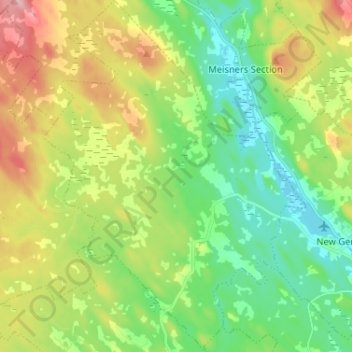
Name: Simpsons Corner topographic map, elevation, terrain.
Location: Simpsons Corner, Lunenburg County, Nova Scotia, Canada (44.51658 -64.83722 44.60868 -64.74065)
Average elevation: 116 m
Minimum elevation: 57 m
Maximum elevation: 220 m
Other topographic maps
Click on a map to view its topography, its elevation and its terrain.
Lohnes Lake
Canada > Nova Scotia > Simpsons Corner
Lohnes Lake, Highway 208, Simpsons Corner, Municipality of the District of Lunenburg, Lunenburg County, Nova Scotia, B0R 1E0, Canada
Average elevation: 79 m