Geolocate

La Chimba topographic map

Click on the map to display elevation.

About this map

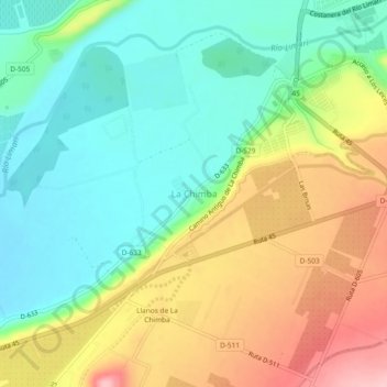
Name: La Chimba topographic map, elevation, terrain.

Location: La Chimba, Ovalle, Provincia de Limarí, Región de Coquimbo, 1840612, Chile (-30.66028 -71.25434 -30.62028 -71.21434)

Average elevation: 233 m

Minimum elevation: 165 m

Maximum elevation: 339 m

Other topographic maps

Click on a map to view its topography, its elevation and its terrain.

Gear up for your next adventure:

🐕Hiking Dog Pack - Let your canine companion carry their own water and food
🥾Mountain Trail Shoes - High-traction shoes for mountain trails
🏕️Camping Hammock - Integrated protection for sleeping between trees
💧Hydration Pack - Hands-free hydration system for long hikes
🧥Packable Rain Jacket - Breathable waterproof layer for unpredictable weather

As an Amazon Associate, this site earns from qualifying purchases at no extra cost to you.