Geolocate

Spanish Fork topographic map

Click on the map to display elevation.

About this map

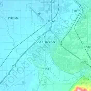
Name: Spanish Fork topographic map, elevation, terrain.

Location: Spanish Fork, Utah County, Utah, 84660, United States (40.06423 -111.69396 40.15858 -111.57470)

Average elevation: 1,407 m

Minimum elevation: 1,370 m

Maximum elevation: 1,994 m

Other topographic maps

Click on a map to view its topography, its elevation and its terrain.

Spanish Fork Peak

United States > Utah > Utah County

Average elevation: 2,720 m

Lone Peak

United States > Utah > Utah County

Average elevation: 3,013 m

Mount Timpanogos

United States > Utah > Utah County

Average elevation: 3,139 m

Bald Mountain Overlook

United States > Utah > Utah County

Average elevation: 2,552 m

Mount Nebo

United States > Utah > Utah County

Average elevation: 3,115 m

Mount Timpanogos

United States > Utah > Utah County

Average elevation: 3,139 m

Curtis

United States > Utah > Utah County > Orem

Average elevation: 1,433 m

Nutty Putty Cave

United States > Utah > Utah County

Average elevation: 1,547 m

Mount Timpanogos

United States > Utah > Utah County

Average elevation: 3,139 m

Caryhurst

United States > Utah > Utah County > Provo

Average elevation: 1,563 m

Birdseye

United States > Utah > Utah County

Average elevation: 1,780 m

Pleasant View

United States > Utah > Utah County > Provo

Average elevation: 1,446 m

Townsend

United States > Utah > Utah County > Genola

Average elevation: 1,438 m

Lone Peak

United States > Utah > Utah County

Average elevation: 3,013 m

Gear up for your next adventure:

🧢Sun Protection Cap - Breathable cap to protect from sun exposure
🥾Hiking Shoes - Durable and comfortable shoes for trail hiking
🪑Insulated Seat Pad - Protect your seat from cold rocks and wet logs
💡LED Camping Lantern - Illuminate your campsite with long-lasting lanterns
🧢Outdoor Visor - Breathable visor for sunny hikes

As an Amazon Associate, this site earns from qualifying purchases at no extra cost to you.