Geolocate

Saint Johns topographic map

Click on the map to display elevation.

About this map

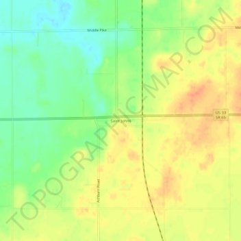
Name: Saint Johns topographic map, elevation, terrain.

Location: Saint Johns, Auglaize County, Ohio, 45884, United States (40.53588 -84.10356 40.57588 -84.06356)

Average elevation: 305 m

Minimum elevation: 282 m

Maximum elevation: 325 m

Other topographic maps

Click on a map to view its topography, its elevation and its terrain.

Uniopolis

United States > Ohio > Auglaize County

Average elevation: 286 m

Buckland

United States > Ohio > Auglaize County

Average elevation: 259 m

Minster

United States > Ohio > Auglaize County

Average elevation: 295 m

New Knoxville

United States > Ohio > Auglaize County

Average elevation: 276 m

Waynesfield

United States > Ohio > Auglaize County

Average elevation: 324 m

Saint Marys

United States > Ohio > Auglaize County

Average elevation: 267 m

Cridersville

United States > Ohio > Auglaize County

Average elevation: 272 m

Gear up for your next adventure:

🦟Insect Repellent - Keep mosquitoes and black flies away in wooded areas
🧥Ultralight Puffy Jacket - Maximum warmth that packs down to the size of an orange
🪜Heavy Duty Carabiners - Multi-use clips for securing gear to your backpack
👟Leg Gaiters - Keep debris, mud, and snow out of your boots
🛰️Satellite Messenger - Emergency communication for areas with no cell service

As an Amazon Associate, this site earns from qualifying purchases at no extra cost to you.