Geolocate

New Washington topographic map

Click on the map to display elevation.

About this map

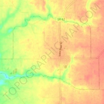
Name: New Washington topographic map, elevation, terrain.

Location: New Washington, Clark County, Indiana, United States (38.54870 -85.58039 38.58338 -85.51882)

Average elevation: 214 m

Minimum elevation: 182 m

Maximum elevation: 230 m

Other topographic maps

Click on a map to view its topography, its elevation and its terrain.

Nabb

United States > Indiana > Clark County

Average elevation: 212 m

Marysville

United States > Indiana > Clark County

Average elevation: 211 m

Underwood

United States > Indiana > Clark County

Average elevation: 194 m

Otisco

United States > Indiana > Clark County

Average elevation: 198 m

Rolling Hills

United States > Indiana > Clark County

Average elevation: 196 m

Bethlehem

United States > Indiana > Clark County

Average elevation: 170 m

Starlight

United States > Indiana > Clark County

Average elevation: 255 m

Speed

United States > Indiana > Clark County > Speed

Average elevation: 147 m

Owen

United States > Indiana > Clark County

Average elevation: 182 m

Gear up for your next adventure:

👟Trail Running Shoes - Agile footwear for fast-paced topographic exploration
Camping Tent - Weather-resistant tents suitable for 2 to 6 people
🥾Lightweight Hiking Boots - Boots for comfort and mobility on long hikes
🥾Approach Boots - Comfortable boots for hiking and climbing approaches
🧦Outdoor Socks - Durable socks designed for hiking and outdoor sports

As an Amazon Associate, this site earns from qualifying purchases at no extra cost to you.