Geolocate

Lodoga topographic map

Click on the map to display elevation.

About this map

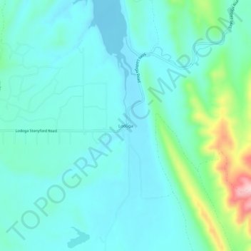
Name: Lodoga topographic map, elevation, terrain.

Location: Lodoga, Colusa County, California, United States (39.28183 -122.50915 39.32183 -122.46915)

Average elevation: 410 m

Minimum elevation: 362 m

Maximum elevation: 623 m

Other topographic maps

Click on a map to view its topography, its elevation and its terrain.

Williams

United States > California > Colusa County

Average elevation: 26 m

Gear up for your next adventure:

🏕️Camping Hammock - Integrated protection for sleeping between trees
🛁Quick-Dry Microfiber Towel - Space-saving towel that dries rapidly on the move
🔭Compact Monocular - One-handed bird watching and trail spotting
🧢Hiking Sun Hat - Wide-brimmed protection for exposed mountain ridges
🧭GPS Outdoor Watch - Smart watch for navigation and fitness tracking in nature

As an Amazon Associate, this site earns from qualifying purchases at no extra cost to you.