Geolocate

Val Soana topographic map

Click on the map to display elevation.

About this map

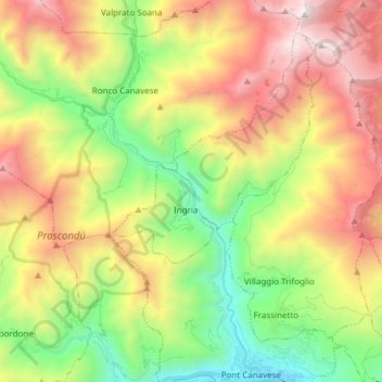
Name: Val Soana topographic map, elevation, terrain.

Location: Val Soana, Ingria, Torino, Piemonte, Italia (45.41847 7.54179 45.52471 7.60473)

Average elevation: 1,456 m

Minimum elevation: 433 m

Maximum elevation: 2,803 m

Other topographic maps

Click on a map to view its topography, its elevation and its terrain.

Albaretto

Italia > Piemonte > Torino > Ingria

Average elevation: 1,134 m

Monteu

Italia > Piemonte > Torino > Ingria

Average elevation: 1,537 m

Gear up for your next adventure:

🔨Vehicle Emergency Tool - Safety tool for remote road trips to trailheads
🥾Mountaineering Boots - Supportive boots for climbing and high-altitude hiking
🥾Lightweight Hiking Shoes - Comfortable shoes for day hikes
🥾Hiking Boots - Sturdy boots providing ankle support and traction on rugged trails
Camping Groundsheet - Protect your tent from moisture and dirt

As an Amazon Associate, this site earns from qualifying purchases at no extra cost to you.