Geolocate

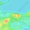
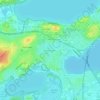
Monona topographic map

Click on the map to display elevation.

About this map
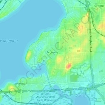
Name: Monona topographic map, elevation, terrain.

Location: Monona, Dane County, Wisconsin, 53708, United States (43.03744 -89.35964 43.08688 -89.30808)

Average elevation: 264 m

Minimum elevation: 256 m

Maximum elevation: 296 m

Other topographic maps

Click on a map to view its topography, its elevation and its terrain.

Waunakee Marsh

United States > Wisconsin > Dane County > Waunakee

Average elevation: 292 m

Buss's Corners

United States > Wisconsin > Dane County

Average elevation: 289 m

Burke

United States > Wisconsin > Dane County > Madison

Average elevation: 292 m

Table Bluff

United States > Wisconsin > Dane County

Average elevation: 306 m

Frederick's Hill

United States > Wisconsin > Dane County

Average elevation: 279 m

Stoughton

United States > Wisconsin > Dane County > Stoughton

Average elevation: 270 m

Bowens Addition

United States > Wisconsin > Dane County > Madison

Average elevation: 266 m

Marxville

United States > Wisconsin > Dane County > Town of Berry

Average elevation: 300 m

East Bristol

United States > Wisconsin > Dane County

Average elevation: 285 m

Gear up for your next adventure:

🪑Insulated Seat Pad - Protect your seat from cold rocks and wet logs
🧳Compression Sacks - Maximize space in your backpack by shrinking gear
🚲Bike Repair Kit - Essential tools for on-trail mechanical issues
🧴Bear Spray Holster - Quick-access carry for essential Canadian wilderness safety
🥾Hiking Leggings - Comfortable leggings for outdoor activities

As an Amazon Associate, this site earns from qualifying purchases at no extra cost to you.