Geolocate

Fairlawn topographic map

Click on the map to display elevation.

About this map

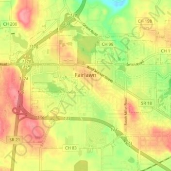
Name: Fairlawn topographic map, elevation, terrain.

Location: Fairlawn, Summit County, Ohio, United States (41.10880 -81.65728 41.14993 -81.58737)

Average elevation: 311 m

Minimum elevation: 260 m

Maximum elevation: 351 m

Other topographic maps

Click on a map to view its topography, its elevation and its terrain.

Metz

United States > Ohio > Summit County > Stow

Average elevation: 318 m

Boston

United States > Ohio > Summit County

Average elevation: 245 m

Maple Grove Park

United States > Ohio > Summit County > Hudson

Average elevation: 316 m

Sagamore Hills

United States > Ohio > Summit County

Average elevation: 264 m

Copley

United States > Ohio > Summit County

Average elevation: 318 m

Myersville

United States > Ohio > Summit County > Green

Average elevation: 342 m

Decker Park

United States > Ohio > Summit County > Barberton

Average elevation: 304 m

Metz

United States > Ohio > Summit County > Stow

Average elevation: 318 m

Gear up for your next adventure:

🦶Hiking Shoe Insoles - Added support for high arches and long days on feet
🧭GPS Outdoor Watch - Smart watch for navigation and fitness tracking in nature
Lightweight Camping Tent - Portable shelter optimized for Canadian backcountry camping
🧥Waterproof Pants - Keep dry during rainy hiking conditions
🧢Hiking Sun Hat - Wide-brimmed protection for exposed mountain ridges

As an Amazon Associate, this site earns from qualifying purchases at no extra cost to you.