Geolocate

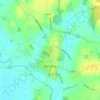
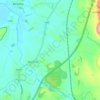
Thrupp topographic map

Click on the map to display elevation.

About this map

Name: Thrupp topographic map, elevation, terrain.

Location: Thrupp, Stroud, Gloucestershire, England, GL5 2DG, United Kingdom (51.71086 -2.22164 51.75086 -2.18164)

Average elevation: 131 m

Minimum elevation: 37 m

Maximum elevation: 250 m

Other topographic maps

Click on a map to view its topography, its elevation and its terrain.
Cranham

United Kingdom > England > Gloucestershire > Stroud

Average elevation: 196 m

Painswick

United Kingdom > England > Gloucestershire > Stroud

Average elevation: 163 m

Berkeley

United Kingdom > England > Gloucestershire > Stroud

Average elevation: 15 m

Stonehouse

United Kingdom > England > Gloucestershire > Stroud

Average elevation: 50 m

Cam

United Kingdom > England > Gloucestershire > Stroud

Average elevation: 69 m

Alderley

United Kingdom > England > Gloucestershire > Stroud

In A Topographical Dictionary of England by Samuel Lewis published in 1831, Alderley is described thus.

Average elevation: 95 m

Frocester

United Kingdom > England > Gloucestershire > Stroud

Average elevation: 57 m

Rodborough

United Kingdom > England > Gloucestershire > Stroud

Average elevation: 105 m

Alkington

United Kingdom > England > Gloucestershire > Stroud

Average elevation: 31 m

Alderley

United Kingdom > England > Gloucestershire > Stroud

In A Topographical Dictionary of England by Samuel Lewis published in 1831, Alderley is described thus.

Average elevation: 95 m

Gear up for your next adventure:

🧥Thermal Layer - Insulating layer for cold outdoor conditions
🌬️Windproof Camp Stove - Efficient cooking even on exposed mountain peaks
🧳Compression Sacks - Maximize space in your backpack by shrinking gear
🧼Travel Hand Sanitizer - Keep hands clean when water is scarce
🕶️Polarized Sunglasses - Reduces glare from snow and water at high elevations

As an Amazon Associate, this site earns from qualifying purchases at no extra cost to you.