Geolocate

Murray topographic map

Click on the map to display elevation.

About this map
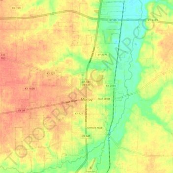
Name: Murray topographic map, elevation, terrain.

Location: Murray, Calloway County, Kentucky, United States (36.57182 -88.36125 36.66204 -88.28567)

Average elevation: 159 m

Minimum elevation: 131 m

Maximum elevation: 178 m

Gear up for your next adventure:

🦯Trekking Poles - Reduced impact on joints for steep topographic climbs
🧦Merino Wool Socks - Moisture-wicking comfort for long-distance hiking
🔦LED Headlamp - Hands-free lighting for early morning starts or late finishes
🚲Handlebar Phone Mount - View topographic-map.com live while cycling
⛺Backpacking Tent - Lightweight tent for long-distance hiking trips

As an Amazon Associate, this site earns from qualifying purchases at no extra cost to you.