Geolocate

Hook topographic map

Click on the map to display elevation.

About this map

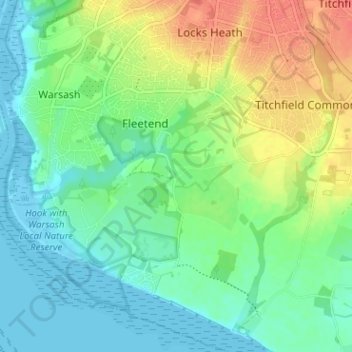
Name: Hook topographic map, elevation, terrain.

Location: Hook, Fareham, Hampshire, England, SO31 9HH, United Kingdom (50.82536 -1.29780 50.86536 -1.25780)

Average elevation: 17 m

Minimum elevation: -4 m

Maximum elevation: 46 m

Gear up for your next adventure:

🧭GPS Handheld Device - Reliable GPS navigation for outdoor adventures
🧰Emergency Multi-Tool - Compact multi-tool for outdoor survival
🚲Heavy Duty Bike Lock - Secure your bike at the trailhead or during stops
🥾Mountain Trail Shoes - High-traction shoes for mountain trails
🧣Evaporative Cooling Towel - Beat the heat during intense summer climbs

As an Amazon Associate, this site earns from qualifying purchases at no extra cost to you.