Geolocate

Bulkhead topographic map

Click on the map to display elevation.

About this map

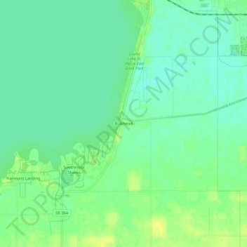
Name: Bulkhead topographic map, elevation, terrain.

Location: Bulkhead, Auglaize County, Ohio, 45885, United States (40.50060 -84.44134 40.54060 -84.40134)

Average elevation: 266 m

Minimum elevation: 258 m

Maximum elevation: 275 m

Other topographic maps

Click on a map to view its topography, its elevation and its terrain.

Minster

United States > Ohio > Auglaize County

Average elevation: 295 m

Uniopolis

United States > Ohio > Auglaize County

Average elevation: 286 m

Buckland

United States > Ohio > Auglaize County

Average elevation: 259 m

New Knoxville

United States > Ohio > Auglaize County

Average elevation: 276 m

Waynesfield

United States > Ohio > Auglaize County

Average elevation: 324 m

Saint Marys

United States > Ohio > Auglaize County

Average elevation: 267 m

Cridersville

United States > Ohio > Auglaize County

Average elevation: 272 m

Gear up for your next adventure:

🛶Canoe Life Vest - Safety vest for water sports
🪑Ultralight Camping Stool - Compact seating for rest stops during long hikes
🧢Sun Hat - Wide-brim hat for sun protection
🚲Handlebar Phone Mount - View topographic-map.com live while cycling
🧰Emergency Multi-Tool - Compact multi-tool for outdoor survival

As an Amazon Associate, this site earns from qualifying purchases at no extra cost to you.