Geolocate

Oriskany topographic map

Click on the map to display elevation.

About this map

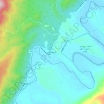
Name: Oriskany topographic map, elevation, terrain.

Location: Oriskany, Botetourt County, Virginia, 24130, United States (37.59652 -80.00366 37.63652 -79.96366)

Average elevation: 404 m

Minimum elevation: 319 m

Maximum elevation: 750 m

Other topographic maps

Click on a map to view its topography, its elevation and its terrain.

Troutville

United States > Virginia > Botetourt County

Average elevation: 458 m

Daleville

United States > Virginia > Botetourt County

Average elevation: 412 m

Buchanan

United States > Virginia > Botetourt County

Average elevation: 344 m

Gear up for your next adventure:

🕶️Polarized Sunglasses - Protect your eyes with durable polarized lenses
🧢Sun Protection Cap - Breathable cap to protect from sun exposure
🥾Hiking Shorts - Breathable shorts suitable for summer hikes
🔋Solar Power Bank - Keep your GPS and devices charged during long outdoor trips
🧰Emergency Multi-Tool - Compact multi-tool for outdoor survival

As an Amazon Associate, this site earns from qualifying purchases at no extra cost to you.