Geolocate

Muskö topographic map

Click on the map to display elevation.

About this map

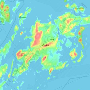
Name: Muskö topographic map, elevation, terrain.

Location: Muskö, Haninge kommun, Stockholm County, 148 95, Sweden (58.96035 18.04745 59.03132 18.23200)

Average elevation: 8 m

Minimum elevation: -2 m

Maximum elevation: 60 m

Gear up for your next adventure:

🧢Hiking Sun Hat - Wide-brimmed protection for exposed mountain ridges
🦟Insect Repellent - Keep mosquitoes and black flies away in wooded areas
🥾All-Terrain Hiking Boots - Versatile boots for varied hiking conditions
🧦Merino Wool Socks - Moisture-wicking comfort for long-distance hiking
💧Reusable Water Bottle - Durable water bottles for hydration on trails

As an Amazon Associate, this site earns from qualifying purchases at no extra cost to you.