Geolocate

Riner topographic map

Click on the map to display elevation.

About this map

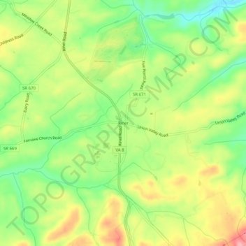
Name: Riner topographic map, elevation, terrain.

Location: Riner, Montgomery County, Virginia, United States (37.04652 -80.46061 37.08652 -80.42061)

Average elevation: 629 m

Minimum elevation: 570 m

Maximum elevation: 697 m

Other topographic maps

Click on a map to view its topography, its elevation and its terrain.

Merrimac

United States > Virginia > Montgomery County > Merrimac

Average elevation: 635 m

Gear up for your next adventure:

🧢Sun Protection Cap - Breathable cap to protect from sun exposure
🚲Bike Repair Kit - Essential tools for on-trail mechanical issues
👟Leg Gaiters - Keep debris, mud, and snow out of your boots
🧴Waterproofing Spray - Restore the DWR coating on jackets and tents
🎒Backpack Rain Cover - External shield to keep your entire pack dry

As an Amazon Associate, this site earns from qualifying purchases at no extra cost to you.