Geolocate

Merrimac topographic map

Click on the map to display elevation.

About this map

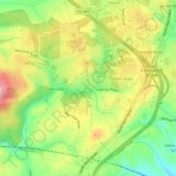
Name: Merrimac topographic map, elevation, terrain.

Location: Merrimac, Montgomery County, Virginia, United States (37.17651 -80.45003 37.20303 -80.40872)

Average elevation: 635 m

Minimum elevation: 565 m

Maximum elevation: 708 m

Gear up for your next adventure:

🛁Quick-Dry Microfiber Towel - Space-saving towel that dries rapidly on the move
🧭Orienteering Kit - Tools for map reading and navigation in the wild
🧦Hiking Liner Socks - Thin base layer to prevent friction and blisters
🥾Waterproof Hiking Boots - Boots keeping your feet dry in wet conditions
🧥Fleece Jacket - Warm and lightweight jacket for layering

As an Amazon Associate, this site earns from qualifying purchases at no extra cost to you.