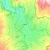
Aldana topographic map
Click on the map to display elevation.
About this map
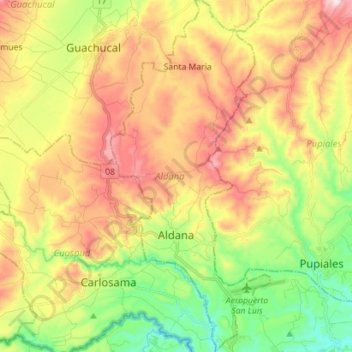
Name: Aldana topographic map, elevation, terrain.
Location: Aldana, Exprovincia de Obando, Nariño, RAP Pacífico, Colombia (0.83544 -77.72653 0.97635 -77.66249)
Average elevation: 3,083 m
Minimum elevation: 2,816 m
Maximum elevation: 3,394 m
Other topographic maps
Click on a map to view its topography, its elevation and its terrain.


Galeras
Numerous minor tremors and ash emissions since March 2006 culminated on 12 July 2006 in three explosive eruptions, producing an ash and gas column reaching an altitude of 8 kilometres (5.0 mi). Rock falls and pyroclastic flows were reported from towns as distant as Consacá, 11.4 kilometres (7.1 mi) west of…
Average elevation: 3,847 m
Pasto
Colombia > Nariño > Pasto > Pasto
Most of the city lies between 2,520 metres (8,270 ft) and 2,700 metres (8,900 ft) elevation above sea level, while some settlement exceeds 3,000 metres (9,800 ft) on the flanks of the Galeras Volcano, which stands at 4,276 metres (14,029 ft).
Average elevation: 2,668 m

Ipiales
Colombia > Nariño > Ipiales > Ipiales
Ipiales is a city and Catholic bishopric in Nariño Department, southern Colombia, near the border with Ecuador. It is located at around 0°49′49″N 77°38′40″W / 0.83028°N 77.64444°W / 0.83028; -77.64444, with an elevation of about 2950 m. Ipiales is located on the high plateau called…
Average elevation: 2,881 m