Geolocate

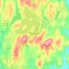
Garrison topographic map

Click on the map to display elevation.

About this map

Name: Garrison topographic map, elevation, terrain.

Location: Garrison, Town of Philipstown, Putnam County, New York, 10996, United States (41.36398 -73.96569 41.40398 -73.92569)

Average elevation: 77 m

Minimum elevation: -3 m

Maximum elevation: 247 m

Other topographic maps

Click on a map to view its topography, its elevation and its terrain.

Mahopac

United States > New York > Putnam County > Town of Carmel

Average elevation: 201 m

Gear up for your next adventure:

⛺Family Camping Tent - Spacious tent suitable for family camping trips
🛌Insulated Sleeping Pad - Critical thermal barrier between you and the cold ground
💧Hydration Bladder - Hands-free hydration solution for long treks
🧦Thermal Socks - Warm socks for winter hiking or camping
🥾Hiking Shorts - Breathable shorts suitable for summer hikes

As an Amazon Associate, this site earns from qualifying purchases at no extra cost to you.