Geolocate

Bulmer topographic map

Click on the map to display elevation.

About this map

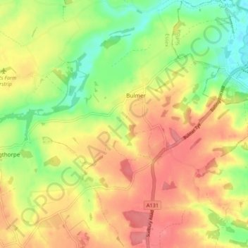
Name: Bulmer topographic map, elevation, terrain.

Location: Bulmer, Braintree, Essex, England, United Kingdom (51.99795 0.65546 52.04864 0.71248)

Average elevation: 60 m

Minimum elevation: 21 m

Maximum elevation: 93 m

Gear up for your next adventure:

Lightweight Camping Tent - Portable shelter optimized for Canadian backcountry camping
🛏️Sleeping Bag - Warm and compact sleeping bags for outdoor camping
🥾Trail Hiking Boots - Supportive boots for rough trails
🧴Sunscreen SPF - Broad-spectrum sunscreen for outdoor activities
🛏️Camping Sleeping Mat - Comfortable mats for sleeping outdoors

As an Amazon Associate, this site earns from qualifying purchases at no extra cost to you.