Geolocate

Cassville topographic map

Click on the map to display elevation.

About this map

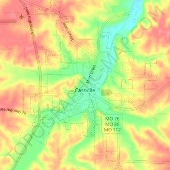
Name: Cassville topographic map, elevation, terrain.

Location: Cassville, Barry County, Missouri, United States (36.65308 -93.89186 36.70386 -93.84199)

Average elevation: 427 m

Minimum elevation: 386 m

Maximum elevation: 458 m

Other topographic maps

Click on a map to view its topography, its elevation and its terrain.

McDowell

United States > Missouri > Barry County

Average elevation: 385 m

Eagle Rock

United States > Missouri > Barry County

Average elevation: 322 m

Gear up for your next adventure:

🧢Outdoor Visor - Breathable visor for sunny hikes
🔭Compact Monocular - One-handed bird watching and trail spotting
🧭GPS Handheld Device - Reliable GPS navigation for outdoor adventures
🎒Hiking Backpack - Lightweight and ergonomic backpacks for day hikes or multi-day treks
🧦Outdoor Socks - Durable socks designed for hiking and outdoor sports

As an Amazon Associate, this site earns from qualifying purchases at no extra cost to you.