Geolocate

Keystone topographic map

Click on the map to display elevation.

About this map
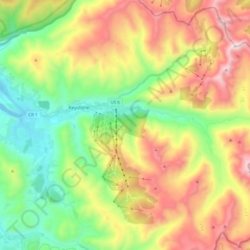
Name: Keystone topographic map, elevation, terrain.

Location: Keystone, Summit County, Colorado, 80435, United States (39.52173 -106.00609 39.67140 -105.86022)

Average elevation: 3,300 m

Minimum elevation: 2,749 m

Maximum elevation: 4,089 m

Gear up for your next adventure:

🥾Mountain Trail Shoes - High-traction shoes for mountain trails
⛺Tent Footprint - Protect tent floor and increase durability
🥾Hiking Shorts - Breathable shorts suitable for summer hikes
🧊Portable Cooler - Keep food and drinks cold during outdoor adventures
💧Hydration Bladder - Hands-free hydration solution for long treks

As an Amazon Associate, this site earns from qualifying purchases at no extra cost to you.