
South Tucson topographic map
Interactive map
Click on the map to display elevation.
About this map
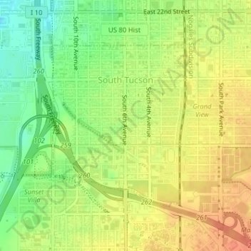
Name: South Tucson topographic map, elevation, terrain.
Location: South Tucson, Pima County, Arizona, United States (32.18582 -110.97821 32.20326 -110.96075)
Average elevation: 741 m
Minimum elevation: 716 m
Maximum elevation: 760 m
Other topographic maps
Click on a map to view its topography, its elevation and its terrain.
Ajo
United States > Arizona > Pima County
Ajo, Pima County, Arizona, 85321, United States
Average elevation: 541 m
San Agustin
United States > Arizona > Pima County
San Agustin, Chukut Kuk District, Pima County, Arizona, United States
Average elevation: 936 m
Oro Valley
United States > Arizona > Pima County > Oro Valley
Oro Valley, Pima County, Arizona, 85737, United States
Average elevation: 874 m