Geolocate

Hamstreet topographic map

Click on the map to display elevation.

About this map

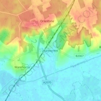
Name: Hamstreet topographic map, elevation, terrain.

Location: Hamstreet, Ashford, Kent, England, TN26 2HE, United Kingdom (51.04490 0.83534 51.08490 0.87534)

Average elevation: 22 m

Minimum elevation: -1 m

Maximum elevation: 57 m

Other topographic maps

Click on a map to view its topography, its elevation and its terrain.

Chilham

United Kingdom > England > Kent > Ashford

Average elevation: 73 m

Wittersham

United Kingdom > England > Kent > Ashford

Average elevation: 18 m

Smarden

United Kingdom > England > Kent > Ashford

Average elevation: 31 m

Kingsnorth

United Kingdom > England > Kent > Ashford

Average elevation: 43 m

Rolvenden

United Kingdom > England > Kent > Ashford

Average elevation: 31 m

Biddenden

United Kingdom > England > Kent > Ashford

Average elevation: 46 m

Tenterden

United Kingdom > England > Kent > Ashford

Average elevation: 28 m

Challock

United Kingdom > England > Kent > Ashford

Average elevation: 136 m

Bethersden

United Kingdom > England > Kent > Ashford

Average elevation: 38 m

Gear up for your next adventure:

Camping Coffee Maker - Brew fresh coffee anywhere on the topographic map
🧥Softshell Hiking Jacket - The perfect balance of wind protection and breathability
Camping Tent - Weather-resistant tents suitable for 2 to 6 people
🧊Insulated Water Bottle - Keeps drinks cold in summer and prevents freezing in winter
🥾Waterproof Hiking Shoes - Durable shoes for wet and rugged trails

As an Amazon Associate, this site earns from qualifying purchases at no extra cost to you.