Geolocate

Smarden topographic map

Click on the map to display elevation.

About this map

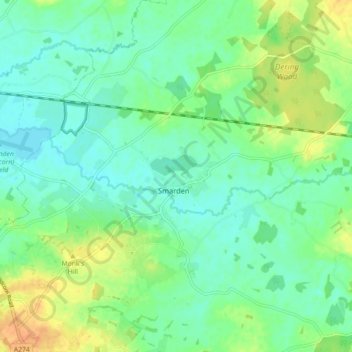
Name: Smarden topographic map, elevation, terrain.

Location: Smarden, Ashford, Kent, England, United Kingdom (51.12324 0.64678 51.17933 0.73402)

Average elevation: 31 m

Minimum elevation: 19 m

Maximum elevation: 54 m

Other topographic maps

Click on a map to view its topography, its elevation and its terrain.

Hamstreet

United Kingdom > England > Kent > Ashford

Average elevation: 22 m

Hinxhill

United Kingdom > England > Kent > Ashford

Average elevation: 51 m

Gear up for your next adventure:

🥾Lightweight Hiking Shoes - Comfortable shoes for day hikes
🥾Trail Hiking Boots - Supportive boots for rough trails
🧊Insulated Water Bottle - Keeps drinks cold in summer and prevents freezing in winter
🔥Emergency Fire Starter - Reliable ignition source for all weather conditions
👖Convertible Hiking Pants - Zip-off legs to adapt to changing weather conditions

As an Amazon Associate, this site earns from qualifying purchases at no extra cost to you.