Geolocate

Freeburn topographic map

Click on the map to display elevation.

About this map
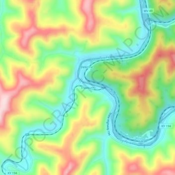
Name: Freeburn topographic map, elevation, terrain.

Location: Freeburn, Pike County, Kentucky, 41528, United States (37.54455 -82.16180 37.58455 -82.12180)

Average elevation: 342 m

Minimum elevation: 207 m

Maximum elevation: 529 m

Gear up for your next adventure:

🧶550 Survival Paracord - Versatile utility cord for emergency repairs and rigging
🧢Sun Protection Cap - Breathable cap to protect from sun exposure
⛺Lightweight Camping Tent - Portable shelter optimized for Canadian backcountry camping
🔦UV Flashlight - Detect minerals or specific insects in the dark
🥾Light Hiking Boots - Lightweight and comfortable boots for day hikes

As an Amazon Associate, this site earns from qualifying purchases at no extra cost to you.