
Gauting topographic map
Click on the map to display elevation.
About this map
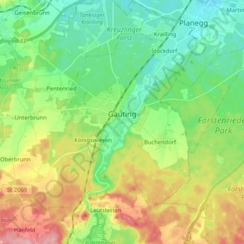
Name: Gauting topographic map, elevation, terrain.
Location: Gauting, Landkreis Starnberg, Bavaria, 82131, Germany (48.02768 11.27599 48.10133 11.42019)
Average elevation: 593 m
Minimum elevation: 541 m
Maximum elevation: 687 m
Other topographic maps
Click on a map to view its topography, its elevation and its terrain.
Stockerbichl
Germany > Bavaria > Landkreis Starnberg > Tutzing > Unterzeismering
Average elevation: 634 m
5er-Grube
Germany > Bavaria > Landkreis Starnberg > Krailling > Kraillinger Innovations Meile KIM
Average elevation: 562 m