Geolocate

Starnberg topographic maps

Click on a map to view its topography, its elevation and its terrain.

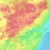
Söcking

Germany > Bavaria > Landkreis Starnberg > Starnberg

Average elevation: 651 m

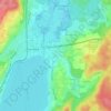
Percha

Germany > Bavaria > Landkreis Starnberg > Starnberg

Average elevation: 609 m

Gear up for your next adventure:

🧭GPS Tracker - Track your location in remote areas safely
🩹Compact First Aid Kit - Pre-packed essentials for common trail injuries
🛌Down Sleeping Bag - Superior warmth-to-weight ratio for cold nights
🔦LED Flashlight - Powerful and long-lasting flashlight for camping and emergencies
⛺Family Camping Tent - Spacious tent suitable for family camping trips

As an Amazon Associate, this site earns from qualifying purchases at no extra cost to you.