
Karluk topographic map
Click on the map to display elevation.
Karluk
According to the United States Census Bureau, the CDP has a total area of 57.9 square miles (149.9 km2), of which 55.4 square miles (143.6 km2) is land and 2.4 square miles (6.3 km2), or 4.20%, is water. Karluk is 88 miles (142 km) southwest of Kodiak City. The elevation is 137 feet (42 m).
About this map
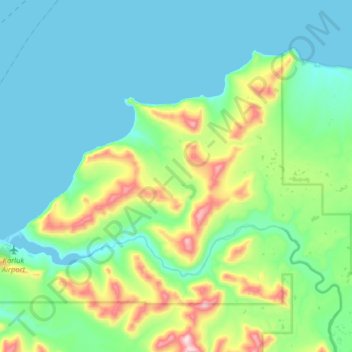
Name: Karluk topographic map, elevation, terrain.
Location: Karluk, Kodiak Island, Alaska, 99608, United States (57.54000 -154.52887 57.66375 -154.20966)
Average elevation: 126 m
Minimum elevation: 0 m
Maximum elevation: 622 m
Other topographic maps
Click on a map to view its topography, its elevation and its terrain.