Geolocate

Newark topographic map

Click on the map to display elevation.

About this map

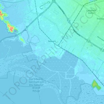
Name: Newark topographic map, elevation, terrain.

Location: Newark, Alameda County, California, 94560, United States (37.47763 -122.07090 37.56368 -121.98779)

Average elevation: 4 m

Minimum elevation: -25 m

Maximum elevation: 83 m

Other topographic maps

Click on a map to view its topography, its elevation and its terrain.

Cherryland

United States > California > Alameda County

Average elevation: 27 m

Gear up for your next adventure:

🦯Trekking Poles - Reduced impact on joints for steep topographic climbs
🥾Lightweight Hiking Shoes - Comfortable shoes for day hikes
🧥Waterproof Jacket - Lightweight rain jackets for hiking and outdoor activities
🥾Trail Hiking Boots - Supportive boots for rough trails
💧Filtered Water Bottle - Safe drinking water on the go

As an Amazon Associate, this site earns from qualifying purchases at no extra cost to you.