
Maasbracht topographic map
Interactive map
Click on the map to display elevation.
About this map
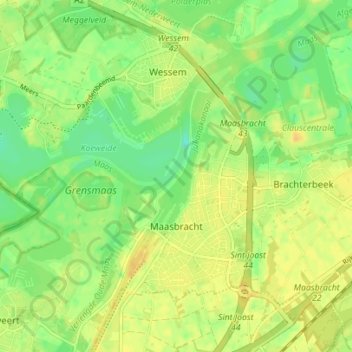
Name: Maasbracht topographic map, elevation, terrain.
Location: Maasbracht, Maasgouw, Limburg, Niederlande (51.13179 5.86077 51.16623 5.93039)
Average elevation: 26 m
Minimum elevation: 11 m
Maximum elevation: 39 m
Other topographic maps
Click on a map to view its topography, its elevation and its terrain.