
Thorn topographic map
Interactive map
Click on the map to display elevation.
About this map
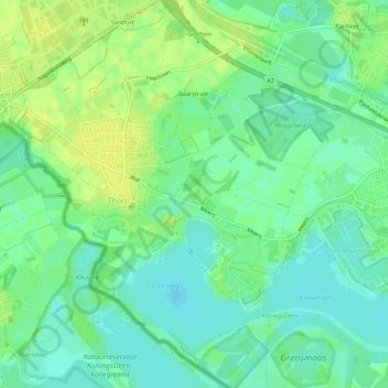
Name: Thorn topographic map, elevation, terrain.
Location: Thorn, Maasgouw, Limburg, Niederlande (51.14464 5.82617 51.17859 5.87540)
Average elevation: 25 m
Minimum elevation: 16 m
Maximum elevation: 34 m
Other topographic maps
Click on a map to view its topography, its elevation and its terrain.
Maasbracht
Niederlande > Limburg > Maasgouw
Maasbracht, Maasgouw, Limburg, Niederlande
Average elevation: 26 m