Geolocate

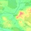
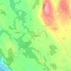
Kinnitty Parish topographic map

Click on the map to display elevation.

About this map

Name: Kinnitty Parish topographic map, elevation, terrain.

Location: Kinnitty Parish, County Offaly, Leinster, R42 W542, Ireland (52.98698 -7.78693 53.15298 -7.58648)

Average elevation: 202 m

Minimum elevation: 58 m

Maximum elevation: 524 m

Other topographic maps

Click on a map to view its topography, its elevation and its terrain.
Daingean

Ireland > County Offaly

Average elevation: 82 m

Cappincur

Ireland > County Offaly

Average elevation: 65 m

Banagher

Ireland > County Offaly > Banagher

Average elevation: 43 m

Charlestown

Ireland > County Offaly > Charlestown

Average elevation: 61 m

Rahan

Ireland > County Offaly

Average elevation: 53 m

Ballycommon

Ireland > County Offaly

Average elevation: 80 m

Rath

Ireland > County Offaly

Average elevation: 66 m

Durrow

Ireland > County Offaly

Average elevation: 66 m

Mount Lucas

Ireland > County Offaly

Average elevation: 76 m

Croghan

Ireland > County Offaly

Average elevation: 100 m

Rathvilla

Ireland > County Offaly

Average elevation: 72 m

Coolderry

Ireland > County Offaly

Average elevation: 107 m

Harbour

Ireland > County Offaly

Average elevation: 62 m

Rahan

Ireland > County Offaly

Average elevation: 53 m

Gear up for your next adventure:

🧢Beanie Hat - Keep your head warm in cold weather
🧊Insulated Water Bottle - Keeps drinks cold in summer and prevents freezing in winter
🔋Emergency Crank Radio - Weather alerts and power without needing batteries
🦯Trekking Poles - Reduced impact on joints for steep topographic climbs
🥾Lightweight Hiking Shoes - Comfortable shoes for day hikes

As an Amazon Associate, this site earns from qualifying purchases at no extra cost to you.