Geolocate

Moel Fferna topographic map

Click on the map to display elevation.

About this map
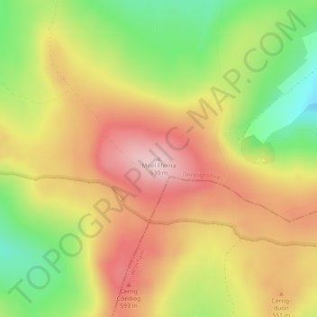
Name: Moel Fferna topographic map, elevation, terrain.

Location: Moel Fferna, Corwen, Denbighshire, Wales, United Kingdom (52.94824 -3.31593 52.94834 -3.31583)

Average elevation: 502 m

Minimum elevation: 361 m

Maximum elevation: 622 m

Other topographic maps

Click on a map to view its topography, its elevation and its terrain.
River Dee

United Kingdom > Wales > Denbighshire > Corwen > Bonwm

Average elevation: 244 m

Gear up for your next adventure:

🔥Emergency Fire Starter - Reliable ignition source for all weather conditions
🧤Insulated Winter Gloves - Heavy-duty protection for sub-zero Canadian adventures
🦟Insect Repellent - Keep mosquitoes and black flies away in wooded areas
⛺Camping Essentials - All-in-one gear for a comfortable camping trip
🔦LED Headlamp - Hands-free lighting for early morning starts or late finishes

As an Amazon Associate, this site earns from qualifying purchases at no extra cost to you.