Geolocate

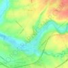
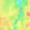
Melle topographic map

Click on the map to display elevation.

About this map

Name: Melle topographic map, elevation, terrain.

Location: Melle, Niort, Deux-Sèvres, Nouvelle-Aquitaine, Metropolitan France, 79500, France (46.14249 -0.21569 46.27410 -0.07284)

Average elevation: 125 m

Minimum elevation: 51 m

Maximum elevation: 182 m

Other topographic maps

Click on a map to view its topography, its elevation and its terrain.
Mardre

France > Nouvelle-Aquitaine > Deux-Sèvres > Melle

Average elevation: 134 m

Feu

France > Nouvelle-Aquitaine > Deux-Sèvres > Celles-sur-Belle

Average elevation: 114 m

Gear up for your next adventure:

☕Camping Coffee Maker - Brew fresh coffee anywhere on the topographic map
⛺Tent Footprint - Protect tent floor and increase durability
🧥Thermal Layer - Insulating layer for cold outdoor conditions
🧭GPS Tracker - Track your location in remote areas safely
👟Trail Running Shoes - Agile footwear for fast-paced topographic exploration

As an Amazon Associate, this site earns from qualifying purchases at no extra cost to you.