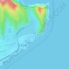
Kapolei topographic map
Click on the map to display elevation.
About this map

Name: Kapolei topographic map, elevation, terrain.
Location: Kapolei, Honolulu County, Hawaii, 96707, United States (21.17401 -158.23785 21.49401 -157.91785)
Average elevation: 77 m
Minimum elevation: -8 m
Maximum elevation: 978 m
Other topographic maps
Click on a map to view its topography, its elevation and its terrain.

Oʻahu
United States > Hawaii > Honolulu County
Oʻahu exhibits a striking and diverse topography shaped primarily by its volcanic origins and subsequent erosion. The island features a rugged landscape dominated by two prominent volcanic mountains, Koʻolau and Waiʻanae, which rise sharply from the coastline, reaching elevations of approximately 4,000…
Average elevation: 79 m




Palolo Valley Recreational Park
United States > Hawaii > Honolulu County > East Honolulu
Average elevation: 144 m
Halawa
United States > Hawaii > Honolulu County > Honolulu
The route of H-3 extends from its western terminus with east–west Moanalua Freeway (H-201; connecting eastward to Honolulu or westward to H-1 and Aiea) to the 1100-foot (335-m) elevation entrance into the Tetsuo Harano Tunnels, penetrating the Ko‘olau crest. The freeway continues beyond to Kaneohe on…
Average elevation: 79 m
Waimānalo Beach Park
United States > Hawaii > Honolulu County > East Honolulu > Waimanalo
Average elevation: 55 m





Pearl Harbor National Memorial
United States > Hawaii > Honolulu County > Waipahu
Average elevation: 9 m







Nihoa Island
United States > Hawaii > Honolulu County
Among features on Nīhoa are Dog's Head Peak (358 ft or 109 m), named for its likeness, and Pinnacle Peak (626 ft or 191 m), a volcanic dike created when less resilient rock was eroded away and harder rock was open to the elements. The only flat area on the island is Albatross Plateau, just below Miller's…
Average elevation: 4 m


Koko Head District Park
United States > Hawaii > Honolulu County > East Honolulu
Average elevation: 47 m