Geolocate

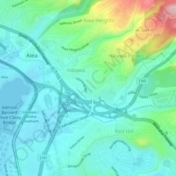
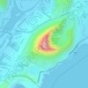
Halawa topographic map

Click on the map to display elevation.

Halawa

The route of H-3 extends from its western terminus with east–west Moanalua Freeway (H-201; connecting eastward to Honolulu or westward to H-1 and Aiea) to the 1100-foot (335-m) elevation entrance into the Tetsuo Harano Tunnels, penetrating the Ko‘olau crest. The freeway continues beyond to Kaneohe on windward Oahu.

Wikipedia (CC-BY-SA 3.0)

About this map

Name: Halawa topographic map, elevation, terrain.

Location: Halawa, Honolulu, Honolulu County, Hawaii, United States (21.36087 -157.93711 21.39410 -157.89816)

Average elevation: 79 m

Minimum elevation: -1 m

Maximum elevation: 307 m

Other topographic maps

Click on a map to view its topography, its elevation and its terrain.
Diamond Head

United States > Hawaii > Honolulu County > Honolulu

Average elevation: 26 m

Diamond Head

United States > Hawaii > Honolulu County > Honolulu

Average elevation: 26 m

Tantalus

United States > Hawaii > Honolulu County > Honolulu

Average elevation: 329 m

Gear up for your next adventure:

🧢Beanie Hat - Keep your head warm in cold weather
🥾Lightweight Hiking Boots - Boots for comfort and mobility on long hikes
🥾Waterproof Hiking Boots - Essential footwear for rugged terrain and wet Canadian trails
🧦Hiking Socks - Moisture-wicking and comfortable socks for long hikes
Camping Tent - Weather-resistant tents suitable for 2 to 6 people

As an Amazon Associate, this site earns from qualifying purchases at no extra cost to you.