Geolocate

Wisley topographic map

Click on the map to display elevation.

About this map

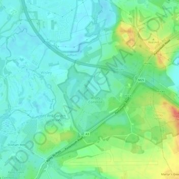
Name: Wisley topographic map, elevation, terrain.

Location: Wisley, Guildford, Surrey, England, United Kingdom (51.30892 -0.48940 51.33152 -0.43662)

Average elevation: 28 m

Minimum elevation: 14 m

Maximum elevation: 60 m

Gear up for your next adventure:

🛁Quick-Dry Microfiber Towel - Space-saving towel that dries rapidly on the move
🎒Hiking Backpack - Lightweight and ergonomic backpacks for day hikes or multi-day treks
🍽️Titanium Camping Spork - Ultralight and indestructible eating utensil
🥾Mountain Trail Shoes - High-traction shoes for mountain trails
🩹Compact First Aid Kit - Pre-packed essentials for common trail injuries

As an Amazon Associate, this site earns from qualifying purchases at no extra cost to you.