Geolocate

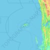
Shire Of Augusta Margaret River topographic map

Click on the map to display elevation.

About this map

Name: Shire Of Augusta Margaret River topographic map, elevation, terrain.

Location: Shire Of Augusta Margaret River, Western Australia, Australia (-34.47615 114.89884 -33.80514 115.66949)

Average elevation: 45 m

Minimum elevation: -2 m

Maximum elevation: 222 m

Other topographic maps

Click on a map to view its topography, its elevation and its terrain.
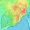
Augusta

Australia > Western Australia > Augusta

Average elevation: 31 m

Kings Park

Australia > Western Australia > Perth

Average elevation: 31 m

Watervalley Park

Australia > Western Australia

Average elevation: 29 m

Honeymoon Bay

Australia > Western Australia

Average elevation: 7 m

Moorehead

Australia > Western Australia

Average elevation: 197 m

Cooke Creek

Australia > Western Australia > Onslow

Average elevation: 2 m

Swan River

Australia > Western Australia

Average elevation: 113 m

Joondalup

Australia > Western Australia

Average elevation: 33 m

Gear up for your next adventure:

🧢Outdoor Cap - Protective cap for sun and rain during hikes
🐕Hiking Dog Pack - Let your canine companion carry their own water and food
🚑Survival Whistle - Signal for help across long distances in mountains
🦟Insect Repellent - Keep mosquitoes and black flies away in wooded areas
🥾Light Hiking Boots - Lightweight and comfortable boots for day hikes

As an Amazon Associate, this site earns from qualifying purchases at no extra cost to you.