
Thank you for supporting this site ❤️
Make a donation
Make a donation
Gear up for your next adventure:
As an Amazon Associate, this site earns from qualifying purchases at no extra cost to you.
Calanda topographic map
Click on the map to display elevation.
Thank you for supporting this site ❤️
Make a donation
Make a donation
Gear up for your next adventure:
As an Amazon Associate, this site earns from qualifying purchases at no extra cost to you.
About this map
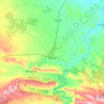
Name: Calanda topographic map, elevation, terrain.
Location: Calanda, Bajo Aragón, Teruel, Aragon, 44570, Spain (40.88533 -0.32371 41.00816 -0.14881)
Average elevation: 504 m
Minimum elevation: 327 m
Maximum elevation: 830 m
Thank you for supporting this site ❤️
Make a donation
Make a donation
Gear up for your next adventure:
As an Amazon Associate, this site earns from qualifying purchases at no extra cost to you.