Geolocate

Walker topographic map

Click on the map to display elevation.

About this map

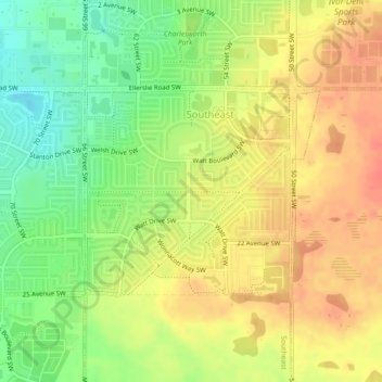
Name: Walker topographic map, elevation, terrain.

Location: Walker, Southeast, Edmonton, Alberta, Canada (53.41031 -113.44273 53.42496 -113.41469)

Average elevation: 716 m

Minimum elevation: 688 m

Maximum elevation: 737 m

Alberta trails, hiking, mountain biking, running and outdoor activities

Other topographic maps

Click on a map to view its topography, its elevation and its terrain.

William Hawrelak Park

Canada > Alberta > Edmonton

Average elevation: 649 m

landslide

Canada > Alberta > Edmonton

Average elevation: 668 m

Horseshoe Lake

Canada > Alberta > Edmonton

Average elevation: 680 m

Ormsby Park

Canada > Alberta > Edmonton

Average elevation: 688 m

Gear up for your next adventure:

🔋Emergency Crank Radio - Weather alerts and power without needing batteries
🥽Outdoor Goggles - Protective eyewear for outdoor activities
🔦LED Headlamp - Hands-free lighting for early morning starts or late finishes
Camping Tent - Weather-resistant tents suitable for 2 to 6 people
🎒Hiking Backpack - Lightweight and ergonomic backpacks for day hikes or multi-day treks

As an Amazon Associate, this site earns from qualifying purchases at no extra cost to you.