Geolocate

Walton topographic map

Click on the map to display elevation.

About this map

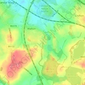
Name: Walton topographic map, elevation, terrain.

Location: Walton, Wakefield, West Yorkshire, England, United Kingdom (53.62419 -1.47712 53.66225 -1.42078)

Average elevation: 55 m

Minimum elevation: 24 m

Maximum elevation: 94 m

Gear up for your next adventure:

Camping Coffee Maker - Brew fresh coffee anywhere on the topographic map
🧢Sun Hat - Wide-brim hat for sun protection
🥾Light Trekking Boots - Supportive boots for multi-day treks
🛶Canoe Life Vest - Safety vest for water sports
🧤Insulated Winter Gloves - Heavy-duty protection for sub-zero Canadian adventures

As an Amazon Associate, this site earns from qualifying purchases at no extra cost to you.