
Batam topographic map
Interactive map
Click on the map to display elevation.
About this map
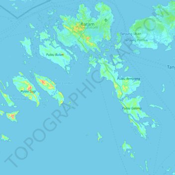
Name: Batam topographic map, elevation, terrain.
Location: Batam, Iles Riau, Sumatra, Indonésie (0.46255 103.65143 1.20472 104.37075)
Average elevation: 4 m
Minimum elevation: -2 m
Maximum elevation: 265 m
L’île fait environ 30 km sur 20 km pour une superficie de 415 km². L’altitude maximale ne dépasse pas 160 m.
Other topographic maps
Click on a map to view its topography, its elevation and its terrain.
Pantai Padang Melang
Indonésie > Îles Riau > Kepulauan Anambas
Pantai Padang Melang, Kepulauan Anambas, Iles Riau, Indonésie
Average elevation: 70 m
Tanjung Pinggir
Indonésie > Îles Riau > Batam > Tanjung Pinggir
Tanjung Pinggir, Batam, Iles Riau, 20444, Indonésie
Average elevation: 6 m