Geolocate

Gardnerville topographic map

Click on the map to display elevation.

About this map

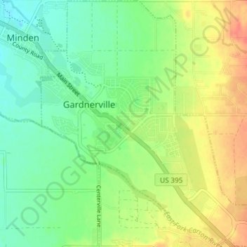
Name: Gardnerville topographic map, elevation, terrain.

Location: Gardnerville, Douglas County, Nevada, 89410, United States (38.91424 -119.76135 38.96131 -119.70264)

Average elevation: 1,452 m

Minimum elevation: 1,436 m

Maximum elevation: 1,477 m

Gear up for your next adventure:

🛰️Satellite Messenger - Emergency communication for areas with no cell service
🦶Hiking Shoe Insoles - Added support for high arches and long days on feet
🥾Light Hiking Boots - Lightweight and comfortable boots for day hikes
🛶Canoe Life Vest - Safety vest for water sports
🌬️Windproof Camp Stove - Efficient cooking even on exposed mountain peaks

As an Amazon Associate, this site earns from qualifying purchases at no extra cost to you.