Geolocate

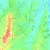
Ambernac topographic map

Click on the map to display elevation.

Ambernac

The relief of the commune is that of a plateau with an average altitude of 190 m; quite hilly as it is traversed from south to north by several valleys including that of the Charente to the west. The highest point of the commune is at an altitude of 232 m located in the Ambouriane Forest in the north-east. The lowest point is 147 m located along the Charente on the northern boundary. The village overlooks the confluence of the Charente and the Braillou and is 185 m above sea level.

Wikipedia (CC-BY-SA 3.0)

About this map

Name: Ambernac topographic map, elevation, terrain.

Location: Ambernac, Confolens, Charente, Nouvelle-Aquitaine, Metropolitan France, 16490, France (45.94689 0.50095 46.00915 0.60261)

Average elevation: 190 m

Minimum elevation: 144 m

Maximum elevation: 233 m

Other topographic maps

Click on a map to view its topography, its elevation and its terrain.

Sainte-Barbe

France > Nouvelle-Aquitaine > Charente > Fléac

Average elevation: 59 m

Le Maine

France > Nouvelle-Aquitaine > Charente > Manot

Average elevation: 188 m

La Paizière

France > Nouvelle-Aquitaine > Charente > Bernac

Average elevation: 131 m

Les Vergnes

France > Nouvelle-Aquitaine > Charente > Manot

Average elevation: 182 m

Mauberge

France > Nouvelle-Aquitaine > Charente > Hiersac

Average elevation: 80 m

Fontafie

France > Nouvelle-Aquitaine > Charente

Average elevation: 189 m

Verina

France > Nouvelle-Aquitaine > Charente > Lesterps

Average elevation: 248 m

Servolles

France > Nouvelle-Aquitaine > Charente > Massignac

Average elevation: 249 m

la Pouillargues

France > Nouvelle-Aquitaine > Charente > Juignac

Average elevation: 143 m

Cors

France > Nouvelle-Aquitaine > Charente > Foussignac

Average elevation: 85 m

Basset

France > Nouvelle-Aquitaine > Charente > Juignac

Average elevation: 144 m

Dizedon

France > Nouvelle-Aquitaine > Charente > Châteaubernard

Average elevation: 20 m

Les Gillardes

France > Nouvelle-Aquitaine > Charente > Bioussac

Average elevation: 118 m

Le Maine

France > Nouvelle-Aquitaine > Charente > Champniers

Average elevation: 72 m

La Broue

France > Nouvelle-Aquitaine > Charente > Saint-Gourson

Average elevation: 124 m

Gear up for your next adventure:

⛺Lightweight Camping Tent - Portable shelter optimized for Canadian backcountry camping
🥾Mountain Hiking Shoes - Shoes with superior grip for mountainous terrain
🧥Waterproof Hiking Jacket - Protect yourself from rain and wind while hiking
🧦Crew Hiking Socks - Comfortable socks for long-distance hikes
🔨Vehicle Emergency Tool - Safety tool for remote road trips to trailheads

As an Amazon Associate, this site earns from qualifying purchases at no extra cost to you.