Geolocate

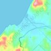
Bucerías topographic map

Click on the map to display elevation.

About this map

Name: Bucerías topographic map, elevation, terrain.

Location: Bucerías, Bahía de Banderas, Nayarit, Mexico (20.74465 -105.35972 20.76586 -105.30434)

Average elevation: 32 m

Minimum elevation: 0 m

Maximum elevation: 201 m

Other topographic maps

Click on a map to view its topography, its elevation and its terrain.

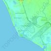
Sayulita

Mexico > Nayarit > Bahía de Banderas

Average elevation: 38 m

Sayulita

Mexico > Nayarit > Bahía de Banderas

Average elevation: 38 m

Sayulita

Mexico > Nayarit > Bahía de Banderas

Average elevation: 38 m

Lo de Marcos

Mexico > Nayarit > Bahía de Banderas

Average elevation: 40 m

Sayulita

Mexico > Nayarit > Bahía de Banderas

Average elevation: 38 m

Gear up for your next adventure:

⛺Lightweight Backpacking Tent - Compact tent for efficient hiking trips
🧭GPS Tracker - Track your location in remote areas safely
🥽Outdoor Goggles - Protective eyewear for outdoor activities
🧴Outdoor Sunscreen - High SPF protection for high-altitude UV exposure
🧰Multitool Knife - Compact and versatile tool for outdoor use

As an Amazon Associate, this site earns from qualifying purchases at no extra cost to you.